

State-of-the-art technology is providing a far more precise picture of Norway’s wetlands. The LAVDAS project is testing new mapping methods to reveal the location of Norway’s peat bogs and fens.
By: Anne Guro Nøkleby, Carl William Lund and Ole Magnus Grønli // Norwegian Mapping Authority
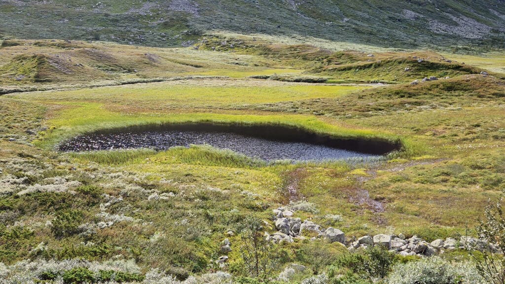
Norwegians typically think of their bogs and fens as places with squishy trails, challenging ground underfoot and a characteristic odour of slow decomposition. And many probably associate them mainly with the rare edible cloudberries known as “Arctic Gold”. Yet the cloudberry’s native habitats also rank among Norway’s most valuable natural resources. Peatlands, also known as mires, bogs and fens, store large amounts of carbon, purify water, and provide habitats that support biodiversity. The total economic value of this ecosystem is estimated to several billion Norwegian Kroner annually.
A few years ago, Norway obtained its first reliable statistical overview of the likely scale of its wetlands, but their exact locations are yet to be determined nationwide. The original map data has gaps, with large areas—especially those above the treeline—lacking updated data. LAVDAS, which stands for Landsdekkende våtmarksdatasett (“Nationwide Wetlands Geospatial Dataset”), will help close the knowledge gaps by using deep neural networks (AI) to identify and delineate wetlands throughout Norway.
From aims to results
LAVDAS aims to improve the national map data on Norway’s wetlands. To achieve this, the project is analysing large volumes of geographical data. The main data sources are satellite images revealing colours and vegetation, and elevation data representing landscape features. The combined data makes it possible to identify patterns typical of different land forms such as wetlands.
Developing an AI model viable for all parts of Norway is a demanding process. The extreme variations in terrain, climate and the seasons affect the appearance of wetlands as seen from satellites in various ways across the country. LAVDAS has consequently developed a range of models, each of which addresses different challenges. The initial model was based on previous research by the Norwegian Institute for Nature Research. The Norwegian Computing Center augmented this model with the aid of extensive training data and by adjusting the parameters. The Google AlphaEarth model with its embedding technology has been tested, and a Foundation Model developed for Climate and Society (FM4CS) has been trialled to understand and analyse the terrestrial surface.
Peatland map data
The most important map data on peatlands is included in the ARS land resource map at a scale of 1:5,000. Beyond the AR5 coverage area, the N50 map data is the most viable source, and forms the basis for the national Norway 1:50,000 map series.
Probability map yields new insights
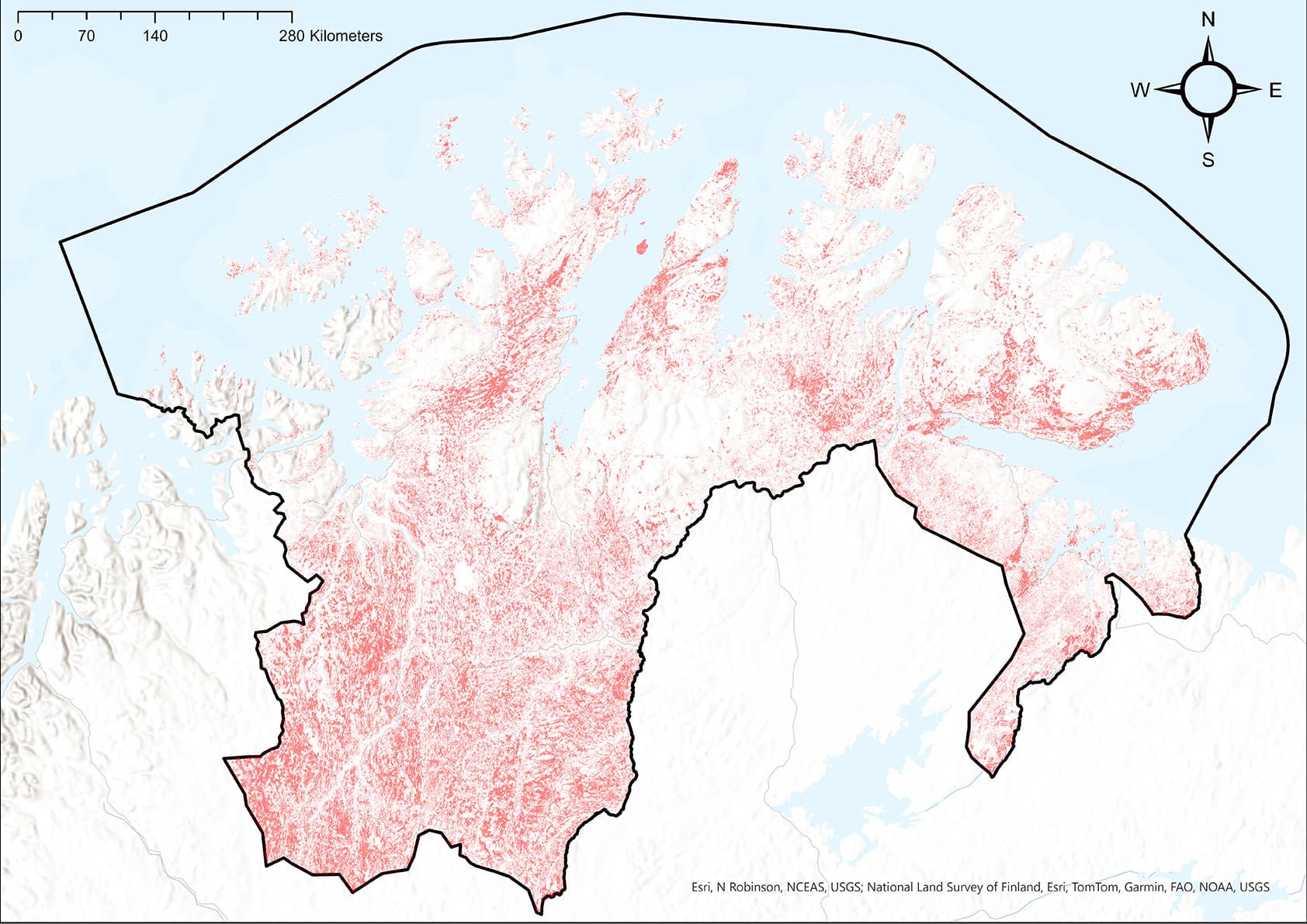
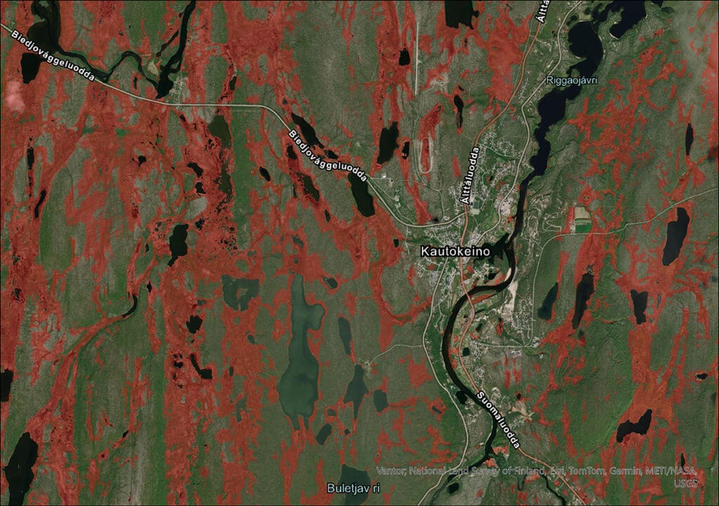
The latest model, a composite of the different models based on an optimised weighting, has yielded promising results rendered as a precise “probability map”. When tested against data from sampling areas evenly spread throughout Norway, contained in a dataset maintained by the Norwegian Institute of Bioeconomy Research, the probability map identified 97.6% of pre-classified pixels correctly. If we then compare the LAVDAS results with the established Land Resource Map (AR5) and the national topographic map dataset of Norway (N50) the estimates of Norwegian peatland cover are very different.
In Finnmark County, for example, detailed data are only available for small areas. The Norwegian Mapping Authority’s national N50 map estimates that around 5% of Finnmark consists of peatland. Meanwhile, AR5, the Norwegian National Land Resource Map shows less peatland cover in Finnmark at only 0.8%. The LAVDAS model, however, shows 12.8% cover, yet also identifies much of the peatland classified in both N50 and AR5. This suggests that current maps provide an inadequate picture of Norwegian wetlands, especially in mountainous regions and in areas such as Finnmark.
Another important task is to set clear threshold values for the probability maps. This includes determining when an area should be classified as peatland and when it should be marked as indeterminate. The task provides valuable experience that can later be applied in mapping other landforms.
Better maps—better decisions
One of the aims of LAVDAS is to make information about Norway’s wetlands, including peatlands, more accessible for natural resource management. To that end, the project started with a wide-ranging survey of user needs. As the project progresses, ongoing dialogue with users will ensure that the data can be used for countryside management, climate action, land use planning and biodiversity conservation. The maps will be made available through Geonorge, the Norwegian national website for map data and other location information. Geonorge and the other joint solutions will be developed over the next few years towards a new collaboration platform, which will hopefully include access to the improved wetland data.
The prospect of a national ban on peatland degradation makes this project even more timely. The Ministry of Climate and Environment and the Ministry of Local Government and Regional Development are proposing incorporation of a prohibition against peatland degradation in the Planning and Building Act, in line with the prohibition against coastal zone construction. If the proposed amendment is adopted, LAVDAS would contribute to ensuring compliance with the regulations. The maps do not provide details of peat depth or peat bog conditions, but may indicate areas that should be investigated further before decisions are made.
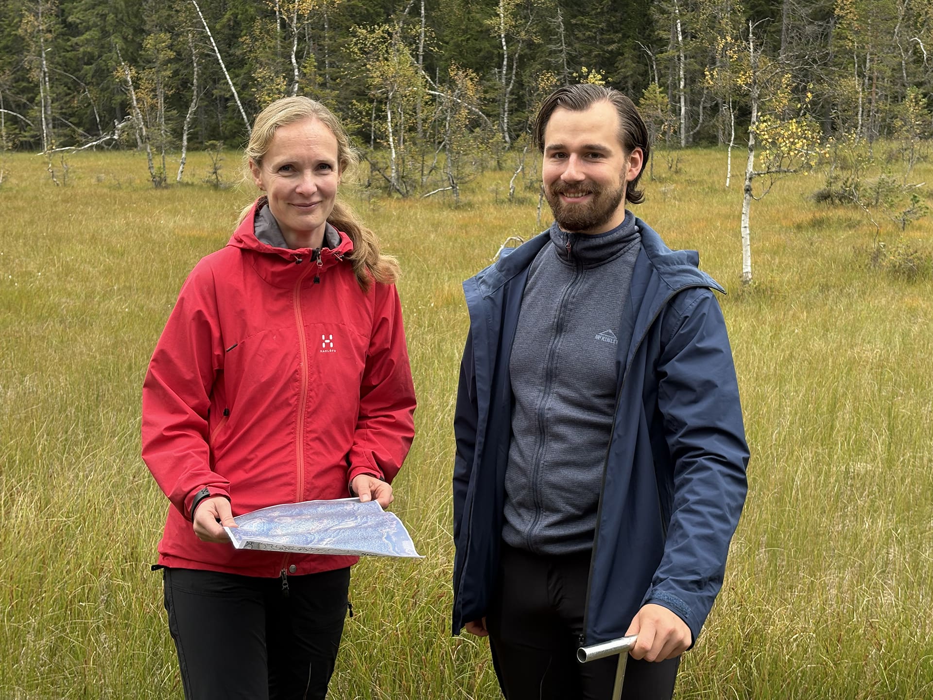
Photo: Ole Magnus Grønli / Norwegian Mapping Authority
The continuation of LAVDAS
Although the results so far are compelling, there are still challenges to overcome. Snow cover, cloud interference, shadows and logging areas can give rise to data interpretation errors. To counter this, the project is working towards including radar data from satellites and incorporating more and better training data, in order to provide more precise results. The project also aims to distinguish between different types of peatlands, including bogs fed by precipitation and fens fed by mineral soil or groundwater. This will provide an even more reliable scientific basis for natural resource management.
Even with these advances, important research remains to be done. LAVDAS only shows what is visible on the surface. Additional metrics and field surveys are still needed to better understand peatland condition, depth and structure.
Future projects could be platformed on LAVDAS and contribute to a more complete picture of Norwegian wetlands.
What is a probability map?
A probability map in LAVDAS shows how likely it is that an area belongs to a certain type of nature, in this case wetlands.
To use the map in practice, a threshold must be set as a criterion for what may be classed as “peatland”, “non-peatland” or “indeterminate”. Such maps provide a more nuanced picture of uncertain landforms than conventional binary boundaries (“yes/no” maps).
Acknowledgements
The LAVDAS project (NFR 349504), funded by the Research Council of Norway and the Norwegian Environment Agency, is a collaboration between the Norwegian Mapping Authority, the Norwegian Environment Agency, the Norwegian Institute of Bioeconomy, the Norwegian Institute for Nature Research and the Norwegian Computing Center.
Further reading
Read more about the LAVDAS project
The National Wetlands Geospatial Database is presented on page 37 of EuroSDR’s annual report for 2024
Maps (in Norwegian) are available digitally at https://norgeskart.no and https://kilden.nibio.no