

The Arctic climate is under rapid transformation, visible not least in the disappearance of sea ice. This is a global concern, demanding an international response. Here we describe one effort to meet this challenge: the INTERAAC project.
By: Wenkai Guo and Jack Landy // UiT The Arctic University of Norway
Shiming Xu // Tsinghua University, China
Sebastian Gerland // Norwegian Polar Institute
The INTERAAC (air-snow-ice-ocean INTERactions transforming Atlantic Arctic Climate) project is a collaboration jointly funded by the Research Council of Norway and the Ministry of Science and Technology of China. The project unites partners from the two countries: UiT The Arctic University of Norway and the Norwegian Polar Institute (NPI), both in Tromsø; Tsinghua University and the Chinese Academy of Meteorological Sciences (CAMS), both in Beijing; and the Polar Research Institute of China (PRIC) in Shanghai. Together, they hope to create unprecedented insights into the changing Arctic environment.
The project aims to characterise changes in sea ice within the Atlantic Sector of the Arctic, a powerful regulator of the regional climate system, over the past three decades. This is achieved by harnessing a wealth of Earth Observation data from satellites and benefiting from several completed Arctic scientific expeditions such as N-ICE2015, MOSAiC, Nansen Legacy—already familiar to readers of Fram Forum—and the FACE (Following Arctic sea iCE) campaigns, run on board the Chinese icebreaker Xuelong 2. The project’s ultimate goal of understanding the interactions between air, snow, ice and ocean is crucial for projecting future climate pathways in the Arctic, which has significant implications for inhabitants of the High North and beyond.
INTERAAC activities
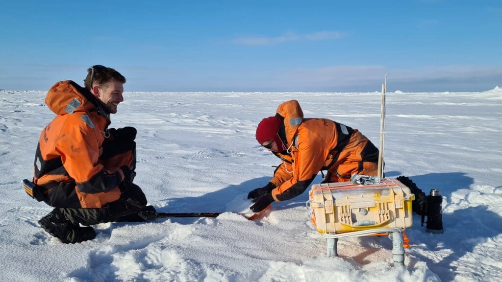
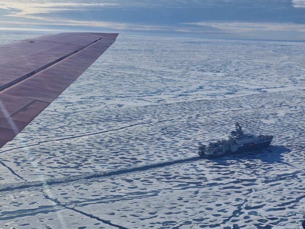
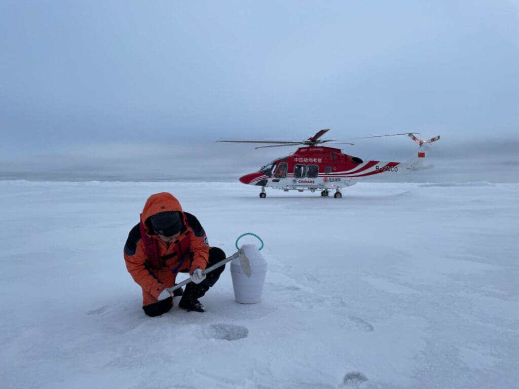
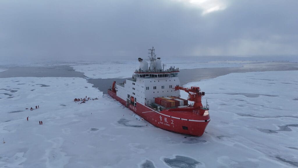
(from top): Norwegian scientists installing a snow ice mass balance apparatus during the CIRFA2022 research cruise; participation on the Alfred Wegener Institute IceBird Summer airborne sea ice remote sensing campaign in August 2024, when the AWI Polar 5 overflew RV Kronprins Haakon in the Central Arctic Ocean; Xuelong 2, one of China’s icebreakers; and a Chinese scientist deploying an ice buoy during one of the yearly Arctic expeditions carried out by Xuelong 2.
Photos: (top) Christian Zoelly / Norwegian Polar Institute; (second) Jack Landy / UiT The Arctic University of Norway; (bottom two) Lin Long / Polar Research Institute of China
Examples of research activities
The INTERAAC project has produced enhanced observational datasets for key sea ice parameters in the Atlantic Arctic, including sea ice coverage, ice types, and ice and snow thickness. UiT brings in the Earth Observation Group’s expertise with sea ice remote sensing to retrieve sea ice type and thickness measurements using satellite Synthetic Aperture Radar (SAR) and altimetry; NPI analyses vast datasets from in situ field campaigns to constrain sea ice processes observed at scale through remote sensing; Tsinghua University are experts in synergising satellite observations from different missions and integrating the data with sea ice and climate modelling; and CAMS and PRIC provide unique field data collected during Chinese polar research expeditions.
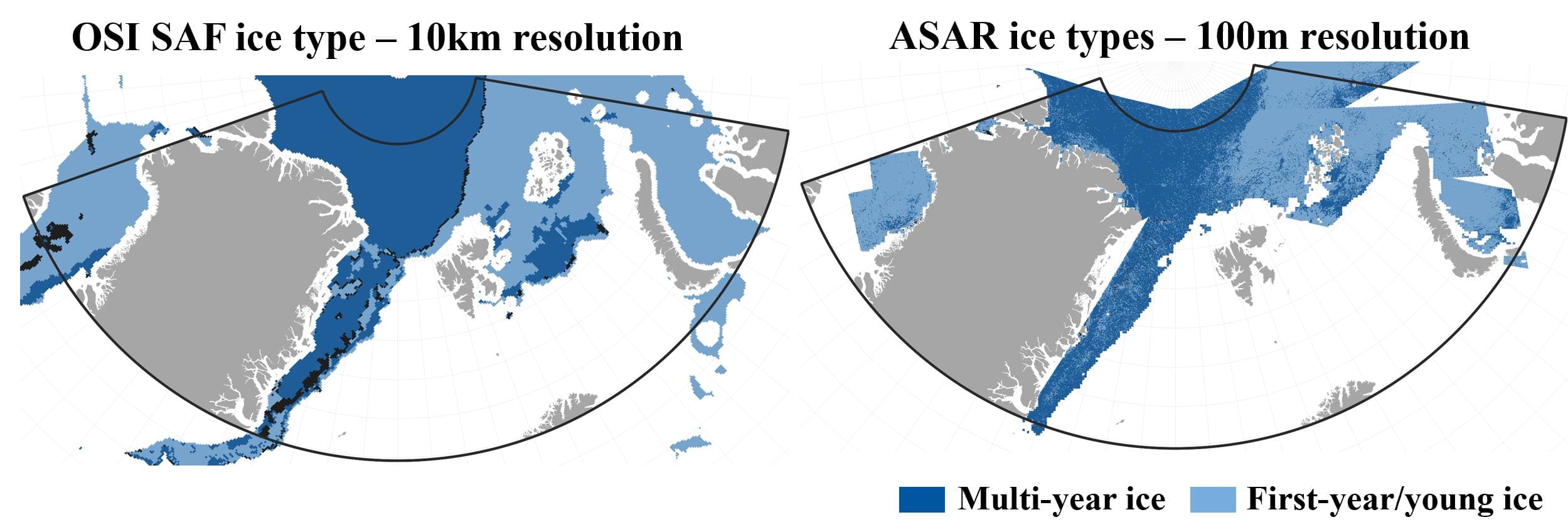
Working together, the team has made significant progress in several key areas. Novel methods have been developed to reconcile legacy and modern C-band radar frequency SAR sensors, enabling estimates of the sea ice type (for example thin ice, level ice, deformed ice, and old ice) to be derived across a 35-year record spanning 1991 to present. Although satellite image coverage over the Atlantic Sector of the Arctic was less rich in the 1990s than it is today, in some key locations this new record has revealed trends in sea ice types—with the replacement of old ice by thinner, younger sea ice—at a level of detail unprecedented with conventional datasets. The SAR record is 100 times more detailed than the information available from existing climate data records. This allowed the team to establish a statistical model for upscaling satellite altimetry measurements of the sea ice freeboard and thickness.
Research visits and collaborations
The collaboration between the Norwegian and Chinese partner institutions has been actively strengthened through a series of mutual visits and in-person exchanges. In 2023, project partners from Beijing visited Tromsø where an in-person workshop was held in Árdna, UiT’s Sami cultural building. In 2025, project members from UiT and NPI visited Beijing for the second in-person workshop. These workshops allowed the project team to jointly refine scientific questions, align data and methods, and plan coordinated research and outreach activities. In addition, early-career researcher Wenkai Guo from UiT completed two research stays at Tsinghua University, while Associate Prof. Shiming Xu from Tsinghua University undertook a corresponding stay at UiT. By strengthening collaboration both between and within Norway and China, and also with other international research teams and projects (e.g., EU Arctic PASSION), INTERAAC builds towards future initiatives like the Arctic Ocean 2050 project and upcoming Earth Observation satellite missions. It has laid a strong foundation for sustaining and expanding Norway–China research collaborations on polar and climate topics in the coming years.