

How healthy are Norway’s marine ecosystems? To answer the question, we need a marine ecosystem account that gives an overview of the ecosystems, their condition, and the services they provide. This helps decision-makers manage marine resources more sustainably and safeguard Norway’s marine areas.
By: Carl William Lund, Noortje Dijkstra Haugstvedt and Kathrin Bögelsack // Norwegian Mapping Authority
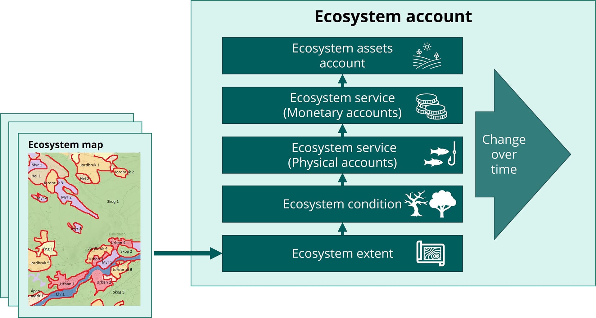
The European Union recently introduced a regulation requiring member countries to report on the state of nature, including the extent of marine areas. Ecosystem accounting is one way to do that. Norway must be ready and actively participate in shaping the process. We explored how existing data can be combined to create digital maps of Norwegian marine ecosystems. The goal? Make the best possible use of what we already know, while identifying gaps that prevent us from seeing the full picture.
Uneven data coverage
We started by reviewing more than 100 available datasets, including raw, processed, and modelled data on depth, substrate, geomorphology, water temperature, salinity, turbidity, and species distribution plus satellite data. Data on human impacts such as pollution, seabed disturbance, and resource extraction are also required and essential for understanding how human activities influence ecosystem conditions and consequently ecosystem services.
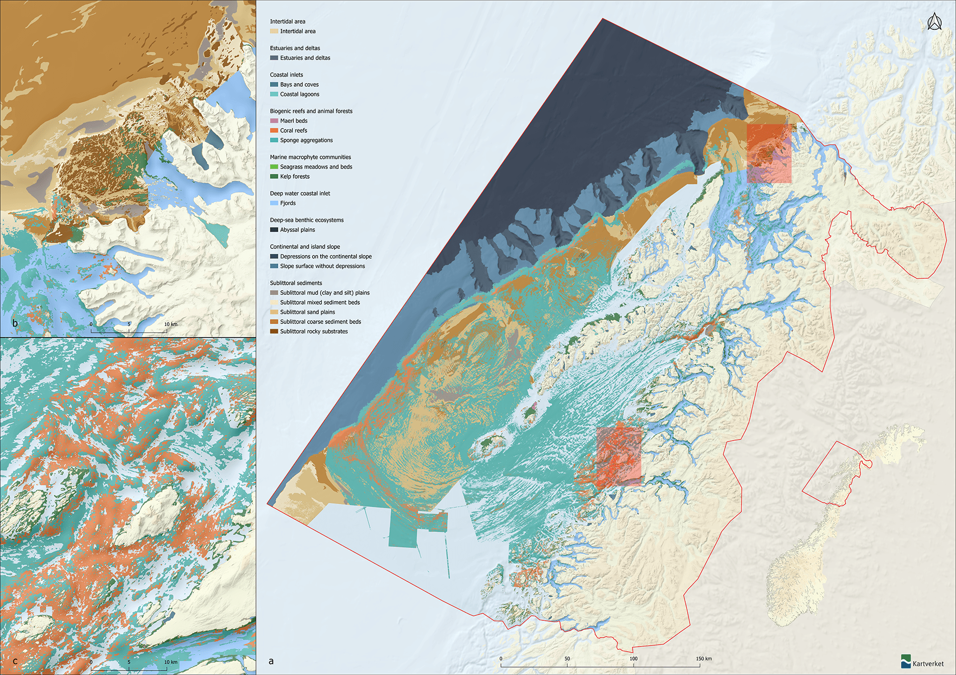
The results show a good starting point, but far from a complete picture. Data coverage is uneven, and many areas have only been mapped once, limiting the ability to track changes over time. Coarse datasets have better coverage than detailed ones but provide less precision. Essential data for modelling species distributions, such as seabed substrate and bathymetry, are lacking for large areas. Vital habitats for invertebrates, such as maerl beds, remain largely unmapped.
Data accessibility is another challenge. Many relevant datasets are not easily available through national portals like Geonorge. Multiple versions of datasets exist; many datasets lack quality standards, and metadata essential for integration and reuse is absent. For example, information on survey coverage is often missing, limiting confidence in the data.
Ecosystem classification challenges
Ecosystem accounting depends not only on accurate and accessible data, but also on a well-defined ecosystem typology. This ensures consistent classification, mapping, and reporting of ecosystem extent, conditions and services. EU’s typology is not always suitable for Norwegian conditions. Norway lacks a solution for sea ice reporting, and its coastline, with inlets, fjords, bays, and coastal archipelagos, is far more complex than that of many European countries. The limited definitions of these coastal landforms make their application to the Norwegian coast difficult. Developing such definitions and adapting EU’s typology for national reporting is an important task.
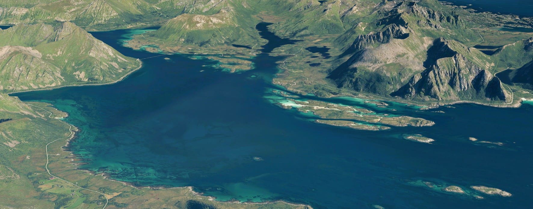
It starts with LoVe
Despite these challenges, progress is being made. A national pilot for marine ecosystem accounting was launched around Lofoten, including Vesterålen (LoVe), a coastal zone classed as “particularly valuable and vulnerable”. Digital ecosystem maps for the pilot area are under development to explore their potential for Norwegian marine management. The pilot will strengthen Norway’s ability to contribute to and influence international frameworks and requirements.
Robust ecosystem accounts serve as important decision-making tools for sustainable ocean management. They help monitor vulnerable areas, track changes in ecosystem extent, and assess the impacts of human activities. To succeed, we must fill the gaps and keep assembling the puzzle, until we see the full picture of Norway’s marine ecosystems.
Acknowledgement
The project is funded by the Norwegian Environment Agency and is a collaboration between the Norwegian Mapping Authority, the Institute of Marine Research, the Geological Survey of Norway, the Norwegian Institute for Water Research, the Norwegian Institute for Nature Research, the Directorate of Fisheries, and Statistics Norway.
Further reading
Eurostat, an official EU website (2025) Ecosystem accounts – measuring the contribution of nature to the economy and human wellbeing
Norwegian government White Paper (2021) Meld. St. 29 (2020–2021) Norway’s integrated plan for the conservation of areas of special importance for marine biodiversity. Chapter 2 of this document describes “particularly valuable and vulnerable areas” in Norway.